Estas son las mejores caminatas en Puerto Rico. Desde los áridos acantilados hasta la selva tropical, el paisaje de senderismo es variado. La mayoría de las caminatas que he enumerado son relativamente suaves, ¡algunas son bastante intensas! Hay muchas caminatas que todavía quiero hacer..
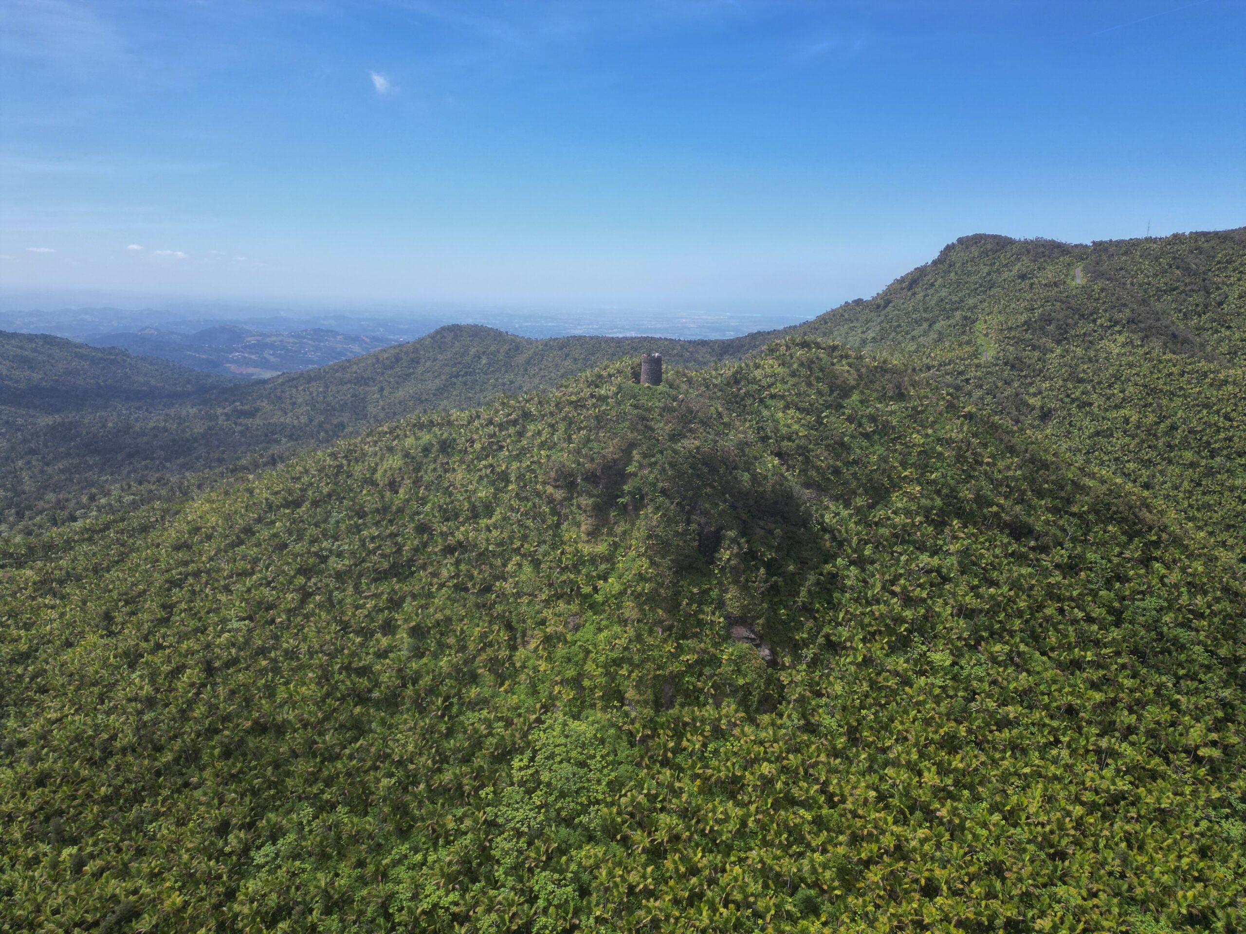
This short trail leads to a stone observation tower with some of the best views in El Yunque. On a clear day, you can see the coastline and even the offshore islands. The climb is not long, but it is steady, and the payoff at the top is worth it. The tower is usually breezy, making it a perfect spot to cool off while taking in the scenery. Check out my El Yunque itinerario de viaje para las mejores caminatas allí.
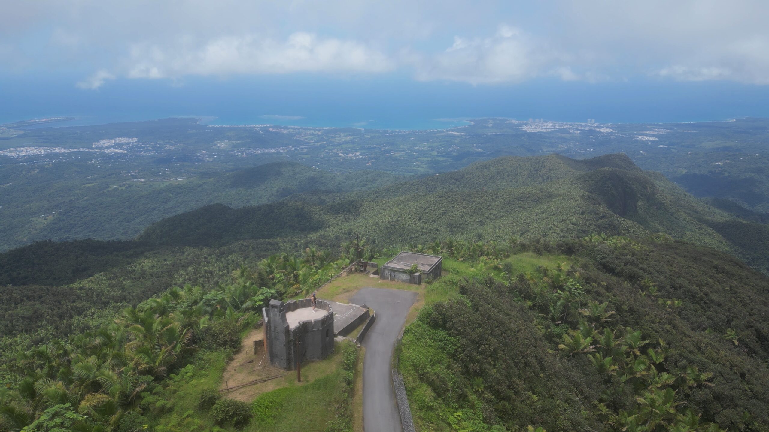
If you have made it to Britton Tower and you are hungry for more, continue to El Yunque Peak. On a clear day, this is one of the best views on the island. Some of the hike is on a service road, so it’s less atmospheric than the Britton Tower hike.
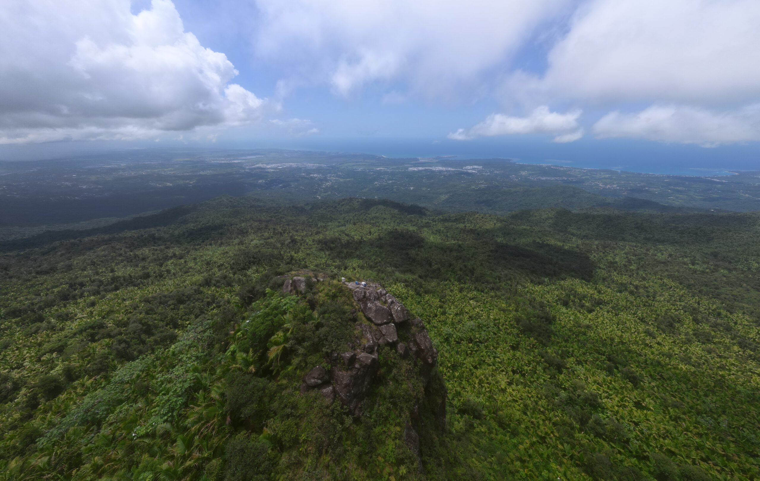
Roca El Yunque is a majestic lookout spot on a protruding rock facing the Atlantic Ocean. It sits in front of El Yunque Peak; it is a short walk from one to the other. Getting this spot to yourself will have you contemplating existence in no time. There is some short scrambling/climbing required so consider skipping in the rain.
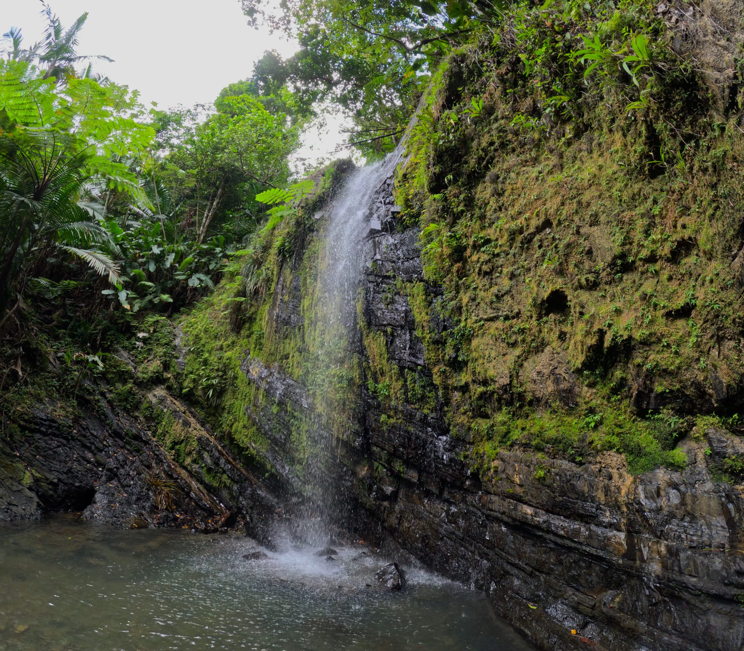
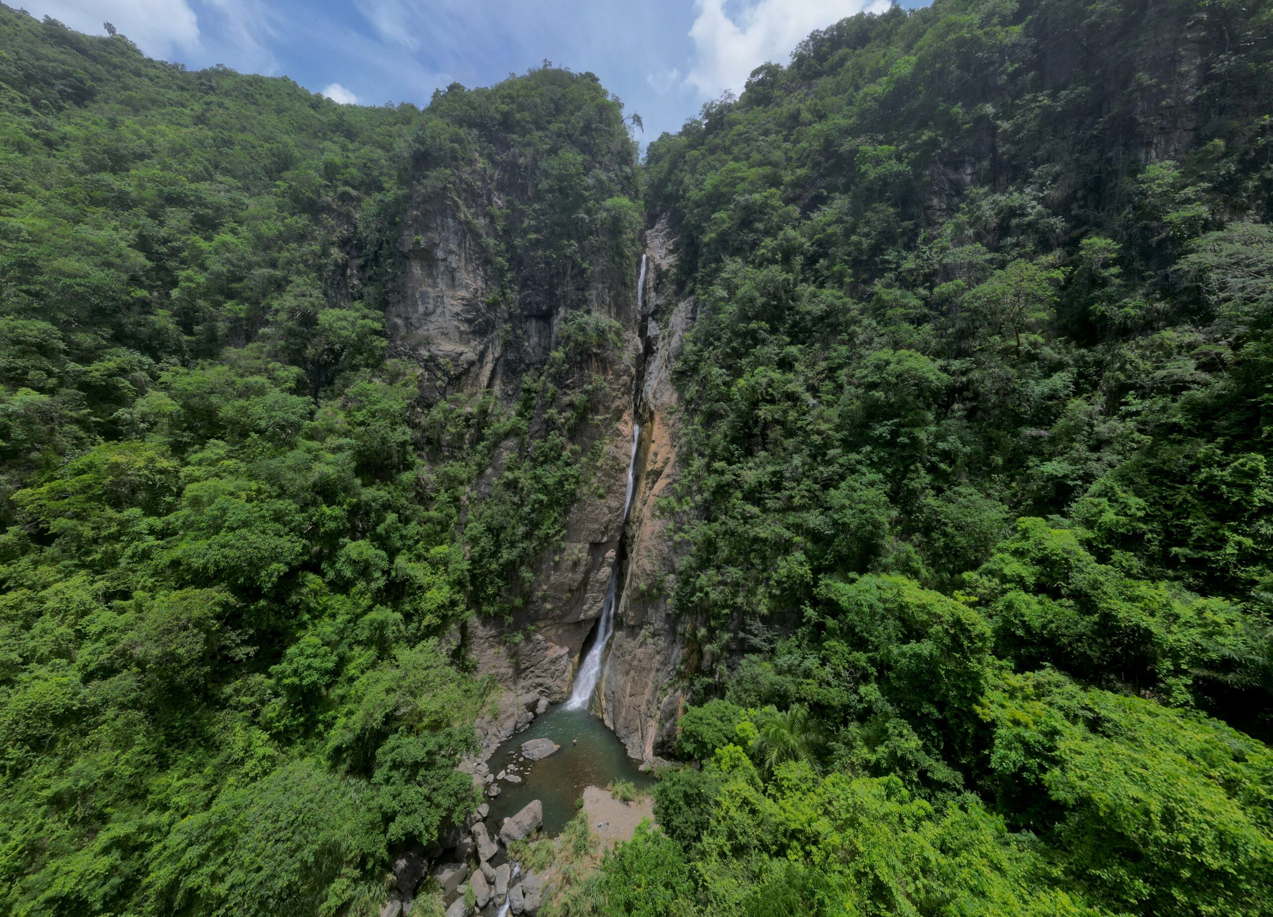
Charco Prieto is one of the tallest waterfalls in Puerto Rico, hidden deep in the forest. The trail follows the river until it opens to a wide pool at the base of the falls. The cascade drops from high above, filling the air with a cool mist that catches the sunlight. The setting feels tucked away and wild, with jungle greenery crowding in around the water.
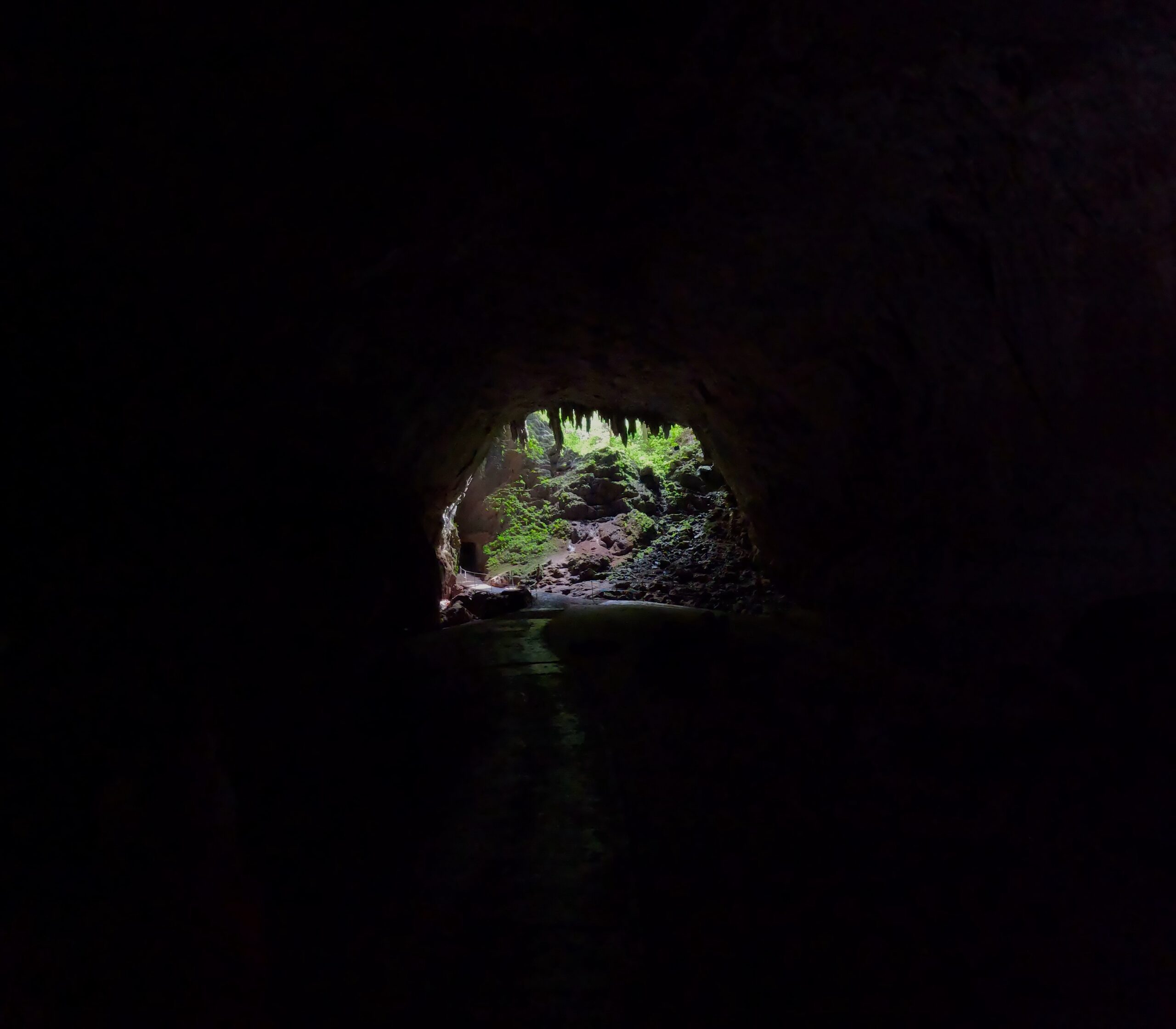
Este parque contiene uno de los sistemas de cuevas más grandes del mundo y atrae a miles de visitantes cada año. Las cuevas se formaron a lo largo de millones de años por el río Camuy, que ha creado una red de cuevas y pasadizos subterráneos. Para acceder a la parte principal, deberá pagar un recorrido en el sitio. El recorrido incluye un vídeo que presenta la ecología y la historia de la cueva, un paseo hasta la boca de la cueva a través del bosque por un camino asfaltado donde el guía turístico le indicará la flora y fauna local (el tranvía que solía pasar por aquí ya no circula). ), y unos auriculares que reproducen información de las diferentes zonas del recorrido al llegar a las ubicaciones numeradas. La parte de las cuevas que se puede ver en una visita guiada es relativamente pequeña. La parte más fresca es una gran cámara llamada Catedral, que tiene más de 200 pies de alto y 600 pies de ancho.
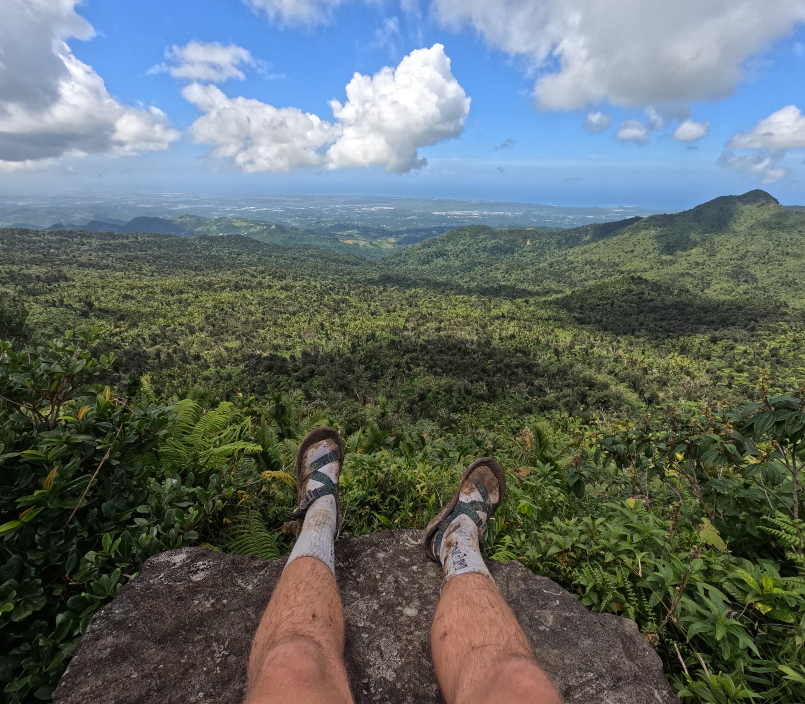
This is easily the most difficult hike I have done in Puerto Rico. Once you reach the peak, you’ll be rewarded with possibly the most spectacular view on the island. You’ll have a nearly 360-degree view of the east coast with the Atlantic Ocean and Caribbean Sea both visible – the full 30-mile width of the island.
I hiked this trail with a very fit 73-year-old friend, and we spent an hour sitting on rocks at the top, catching our breath and soaking in the view. Avid hikers will love this trail, more casual hikers should look elsewhere.
Juan Diego Falls is a serene waterfall tucked into a verdant mountainside. It is the easiest and most accessible “hike” in the forest, which means it is always full of people. The trail leads to a cool, shaded pool at the base of the waterfall. There is another waterfall higher up for those that want to see another.
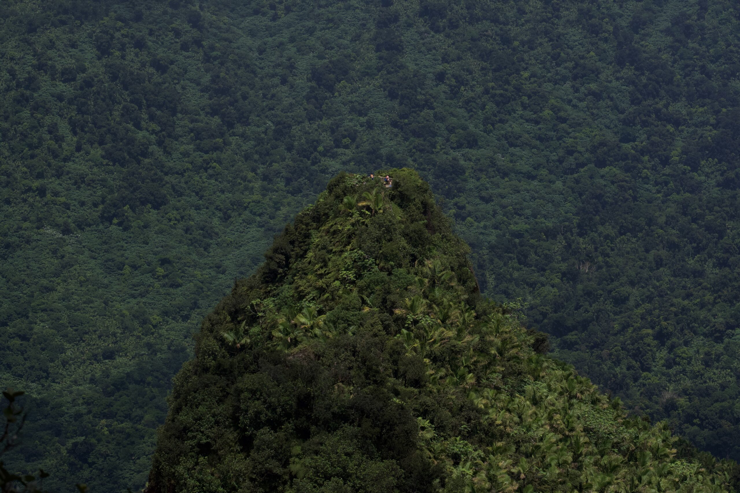
Los Picachos offers a rugged trail that winds through dense forest before opening to sweeping mountain views. The peak rises dramatically above the greenery, giving a sense of being deep in the heart of El Yunque. The trail is quiet and less crowded than some of the other hikes due to being more difficult and often more muddy.
The hike through dense, verdant forest leads to a stunning waterfall. Water glides down smooth rock, creating natural pools wherever it may. At the top, the view stretches across the forest to the Caribbean Sea. This location is very dangerous, and more than one person has died sliding on the smooth rock. I recommend stopping before the dangerous section.
This particular mountain in Jayuya has the highest peak in Puerto Rico at 4398 ft or 1338 meters. You could drive up, but the road is really bad. It’s gotten much worse in the year of 2023. If you don’t have 4-wheel drive, you won’t make it. The hike up the road isn’t too bad, but it is steep. It will take you 20-30 minutes. If you are lucky enough to visit on a clear day, you’ll have 360º views of the island. You can see the ocean on either side, though this peak is closer to the Caribbean Sea. I have done much tougher hikes for worse views; this one is worth it!
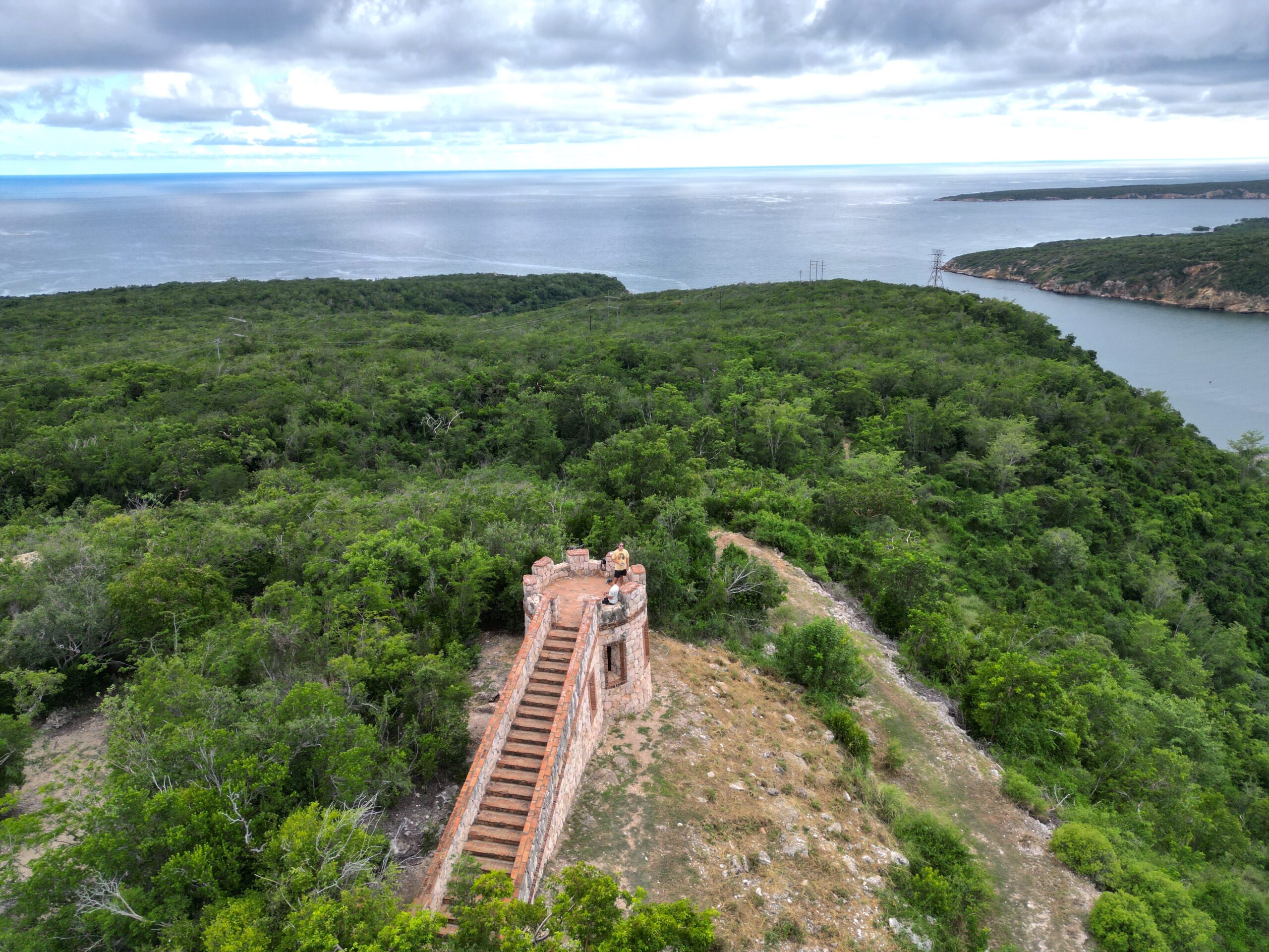
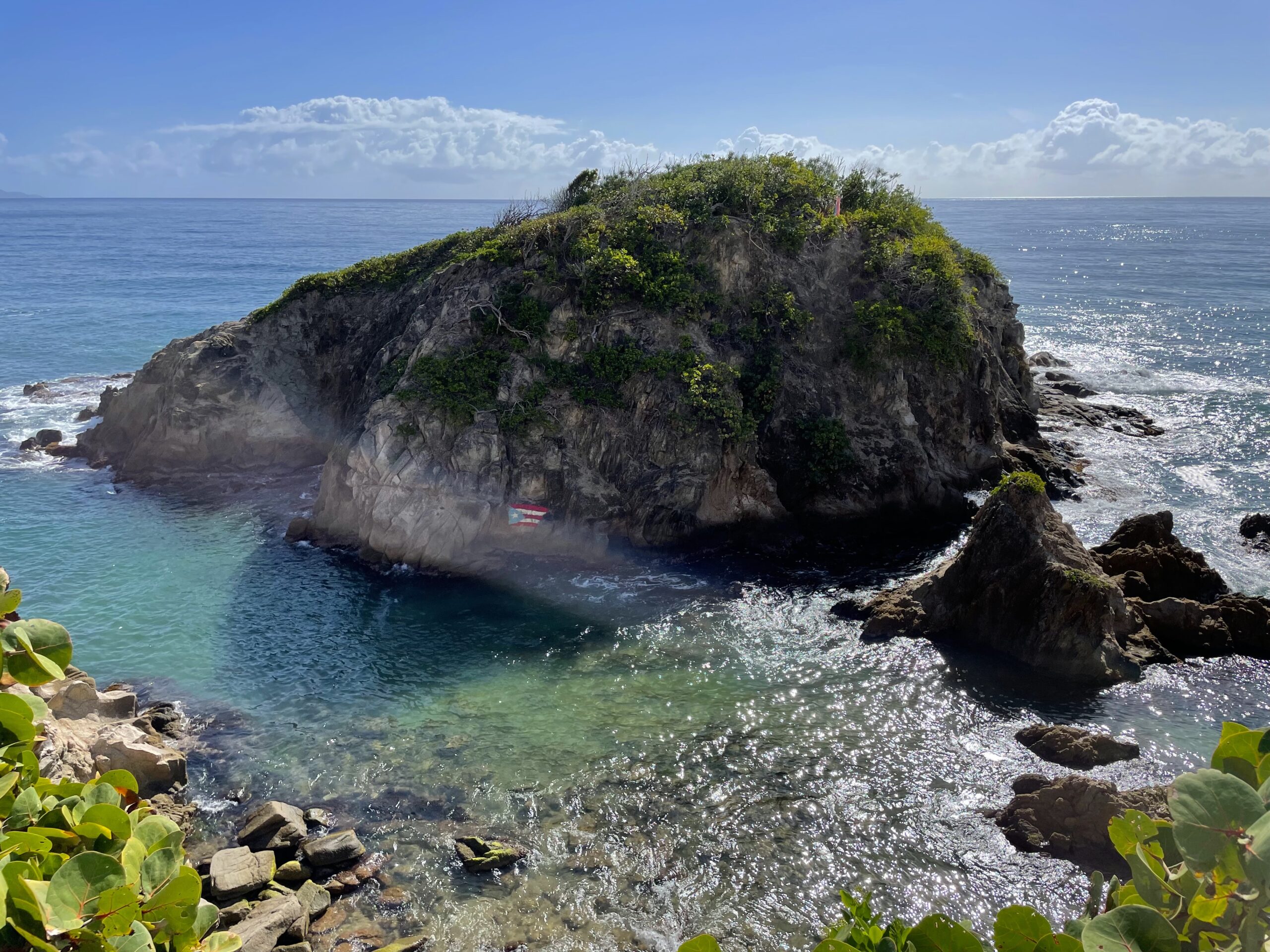
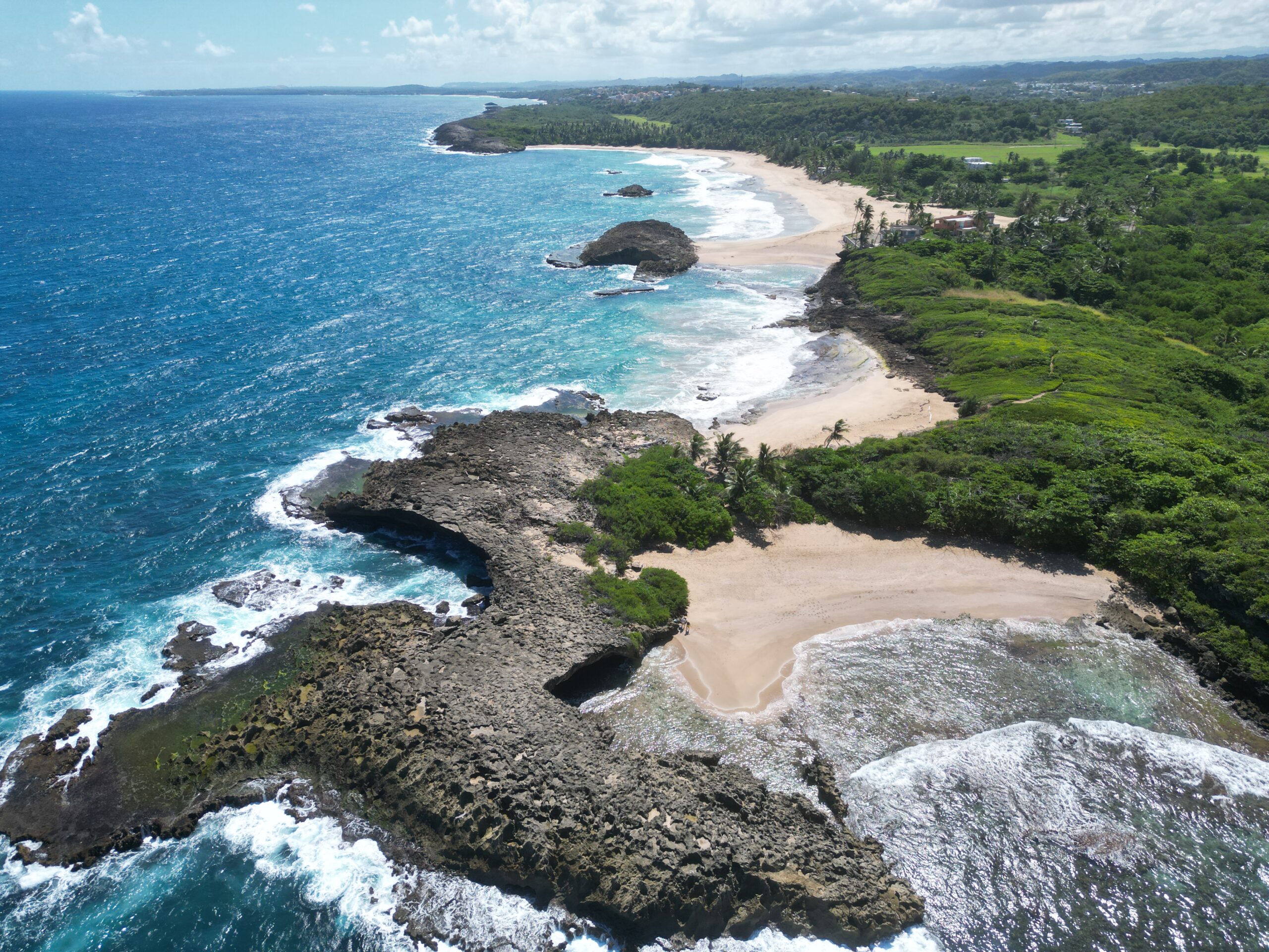
Los Morillos Trail follows the cliffs of a “Y”-shaped peninsula, offering sweeping views of the turquoise waters below and the surrounding desert-like landscape. The path winds past a natural rock bridge and leads to the iconic Morrillos Lighthouse, a striking landmark perched above the Caribbean Sea. The combination of rugged cliffs, scrubby flora, and sparkling ocean makes this trail a memorable coastal hike.
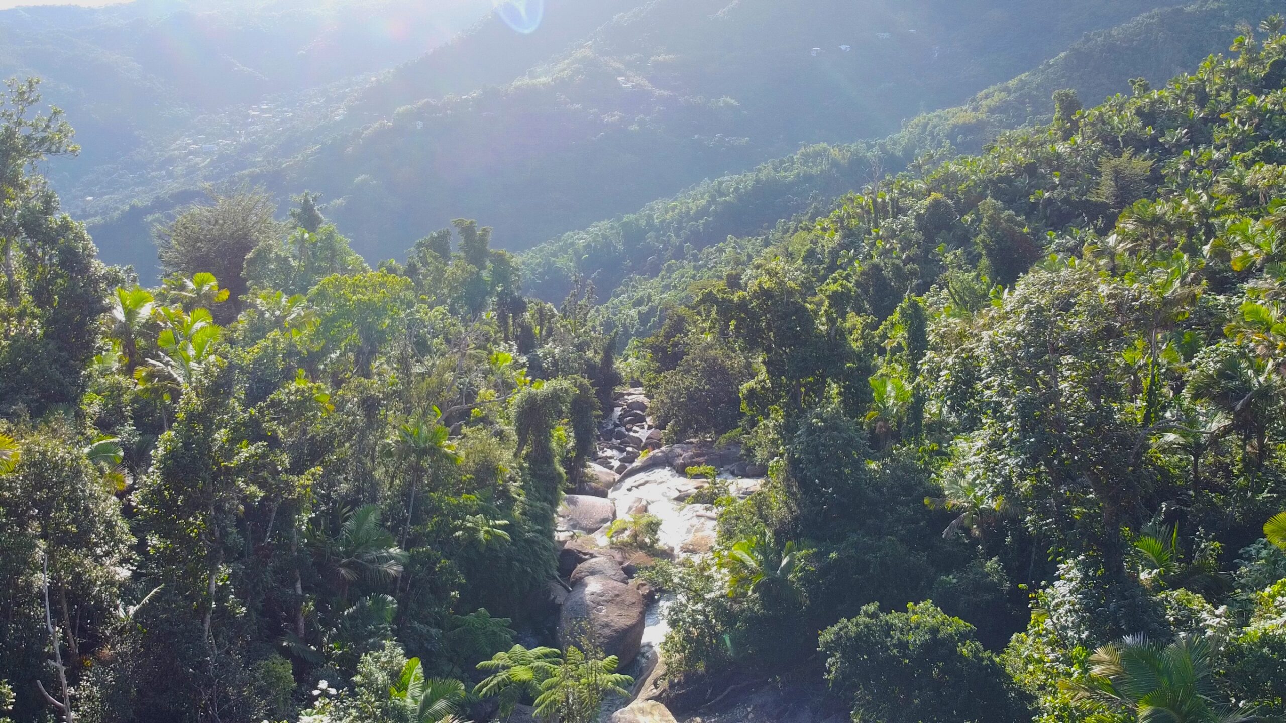
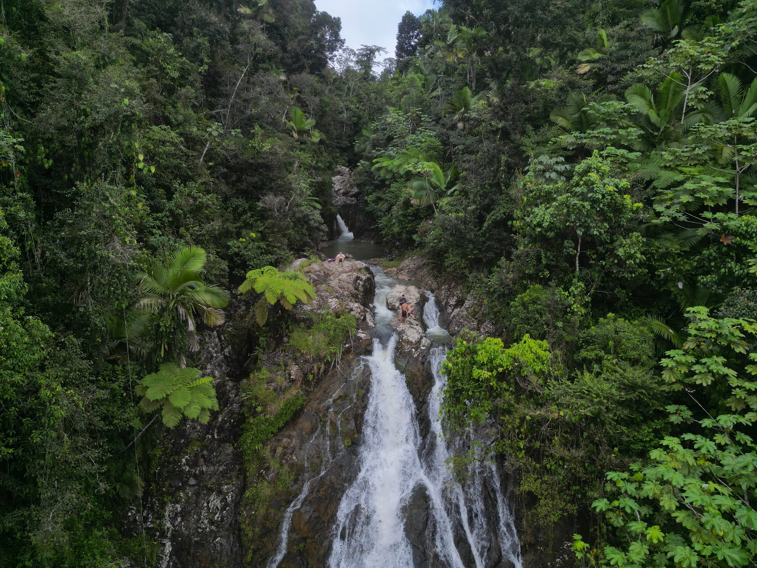
The hike to this long, skinny waterfall is a moderate – easy walk through a beautiful forest. You’ll see all kinds of different birds and trees loaded with mangos during the right season. You’ll pass a grove of tall flamboyan trees and a natural spring pumping water into a hose running down the hill. There is a tough section where you need to climb up a rope towards the end. Cooling off in the water once you arrive feels amazing.
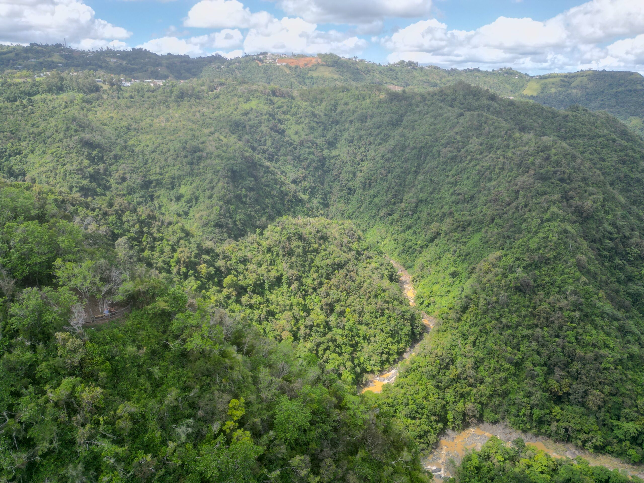
Para La Naturaleza manages the flat, well-kept land you’ll walk through. Much of the trail is a wide grass road with a good view of the other side of the canyon. The last 3rd or so of the trail is a much more narrow trail through the forest until you reach the lookout spot. This area is likely to be more muddy if it has been raining recently. The view of the El Ancón Waterfall is well worth the 3-mile hike.
The hike to the Patillas Infinity Pool is muddy and the trailhead isn’t well-marked, but I enjoyed it! There are wild raspberries and edible flowers to forage along the way. The trail is in the verdant and underrated Carite State Forest. It’s a cloud forest similar to El Yunque with some of the same trees and animals. The trail could use some maintenance, so if you have a machete, consider bringing it along.
Fuerte Caprón is a small lookout tower perched on a hill in Guánica, offering sweeping views of Guánica Bay and the Caribbean Sea. The short hike up is rather gentle but unshaded. Reaching the top rewards you with a panoramic vantage point over the coast; you might consider this hike during whale watching season.
La arena en Playa Puerto Hermina retrocede muy atrás en el bosque. Si lo sigues, encontrarás una agradable ruta de senderismo bordeada de hierba de serpiente entre árboles maduros. Si vas a la izquierda en la primera bifurcación y luego a la derecha en la siguiente, llegarás a una larga puente que abarca el cañón con excelentes vistas del dosel que se encuentra debajo y los acantilados de piedra caliza circundantes. Es una caminata fácil de ida y vuelta de 25 minutos con una ligera pendiente en el camino.
Angelito Trailhead está cerca del área recreativa principal. Estarás recorriendo un sendero muy similar al que encontrarás allí. Esta es una caminata tranquila que conduce al río Mameyes, donde puedes sumergirte en el agua. Es mejor ir cuando no haya llovido recientemente para que el río esté claro y el sendero no esté demasiado embarrado.
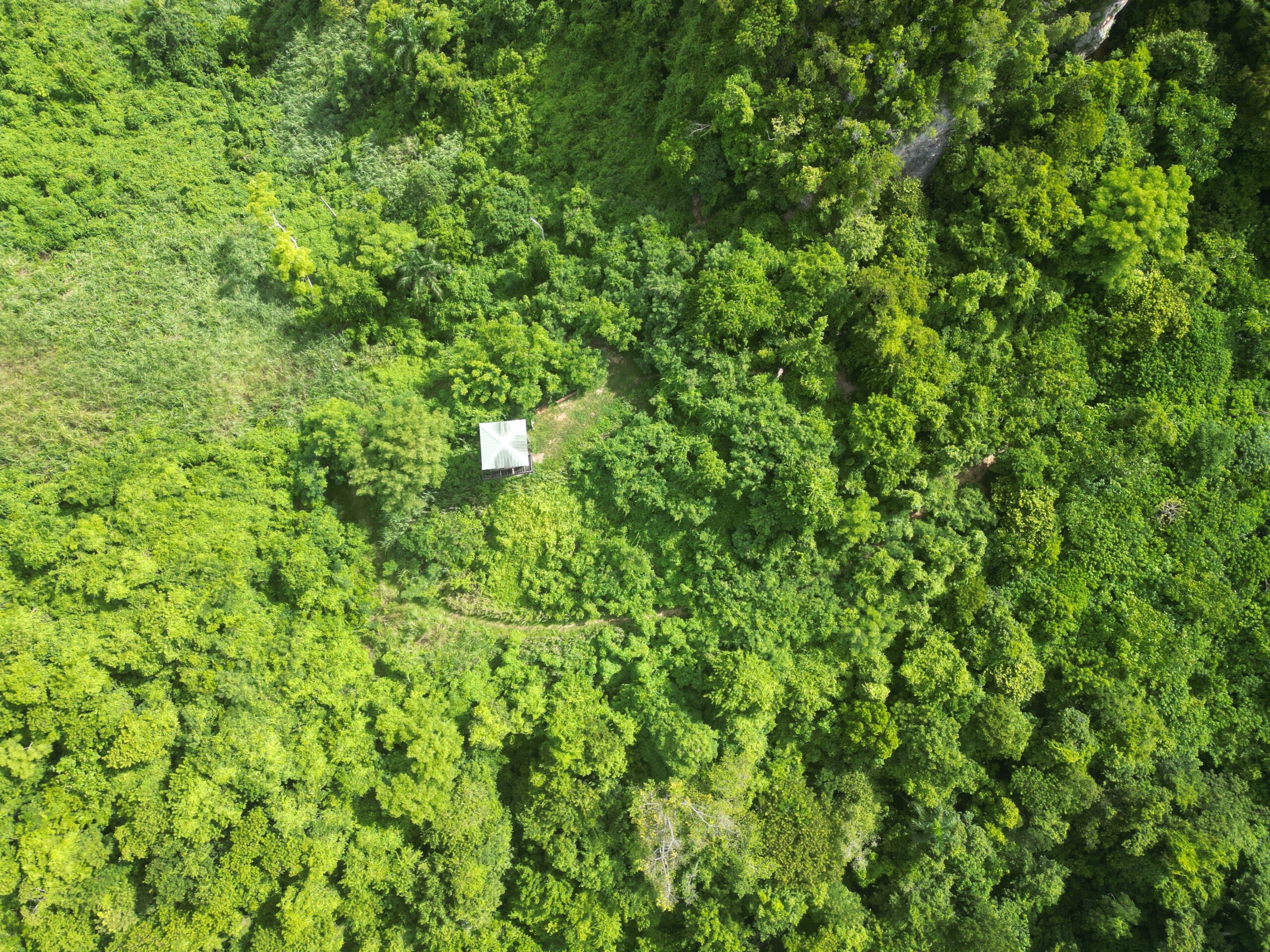
To get to the trails here, you’ll need to enter the Palmas del Mar gated community and tell them you are going to the beach. I enjoyed hiking to Punta Icacos (en la foto) y nadando hasta la cercana Secret Beach. Hay un torre de observación y otra playa a la que puedes acceder por estos senderos.
In Bayamón, tucked behind an industrial park and right next to a women’s detention center, sits a relatively large protected forest area. There is a lot of space for day use, mountain biking trails, hiking trails, and rock climbing. This is one of the most developed, well-maintained, and popular climbing spots on the island. There is an torre de observación that you can hike to, which is sadly closed due to disrepair. But, standing at the foot of the tower is still a good view. There are plenty of trails snaking through this forest. It gets hot and humid here, but the trails are mellow. Parking costs $4.00.
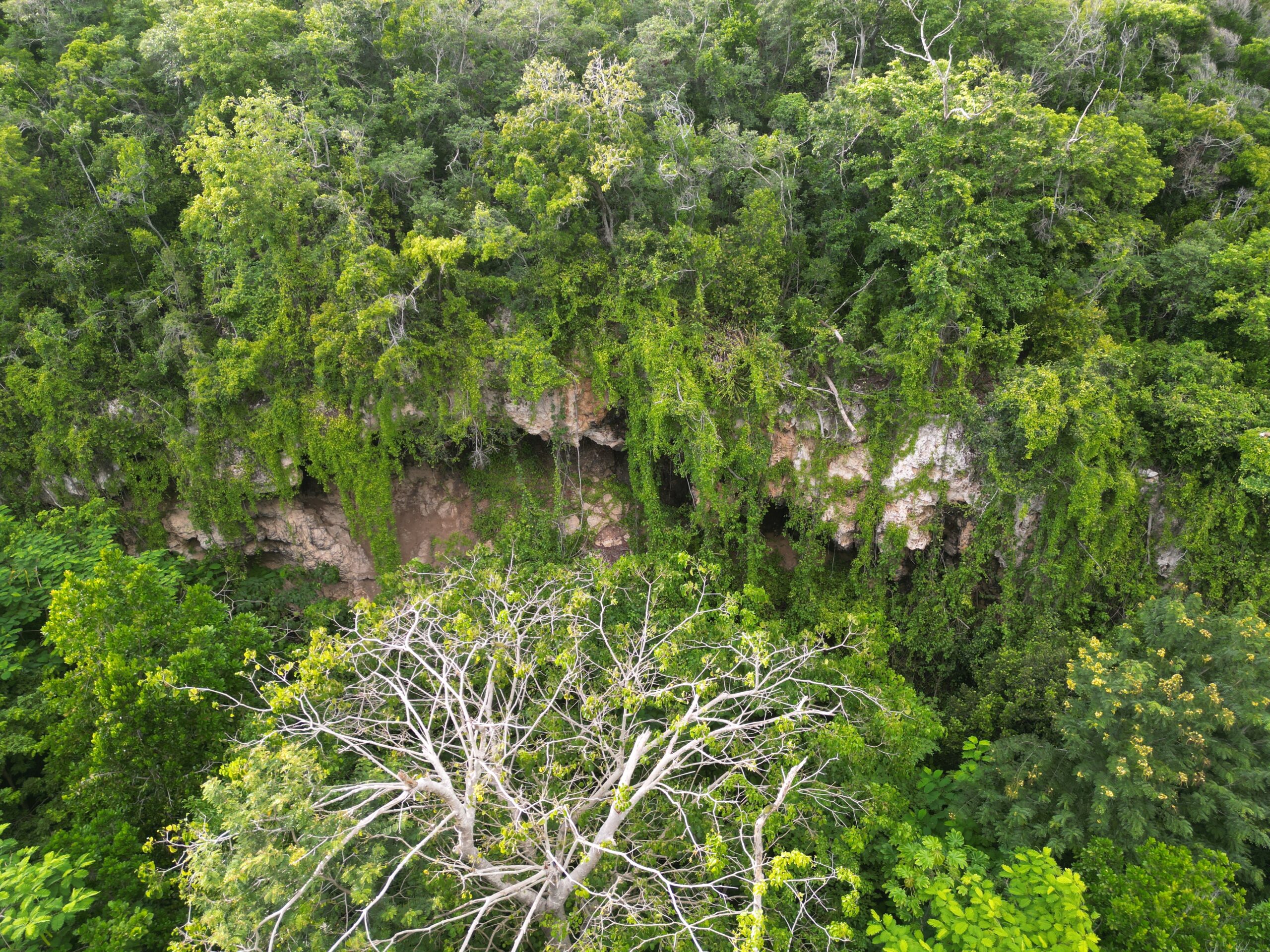
Una caminata fácil a través del bosque en Manatí que lo puede llevar a una laguna (manténgase a la derecha en la primera bifurcación) o a una pequeña manantial (izquierda). Este es un lugar común para practicar ciclismo de montaña y un lugar decente para observar aves. Si eliges ir al manantial, puedes pasarlo y encontrar otra bifurcación en el camino. La izquierda te lleva a través del bosque por un sendero para bicicletas de montaña, la derecha te lleva a algunas cuevas (en la foto). Si vas a la laguna mantén los ojos abiertos, he oído que hay caimanes.
El camino a la Cueva de las Golondrinas is a nice, but very short hike in a nature reserve; it should take about 10 minutes each way. On the way, you’ll see a sign detailing this and other nearby trails. Be careful of hermit crabs crossing the trail!
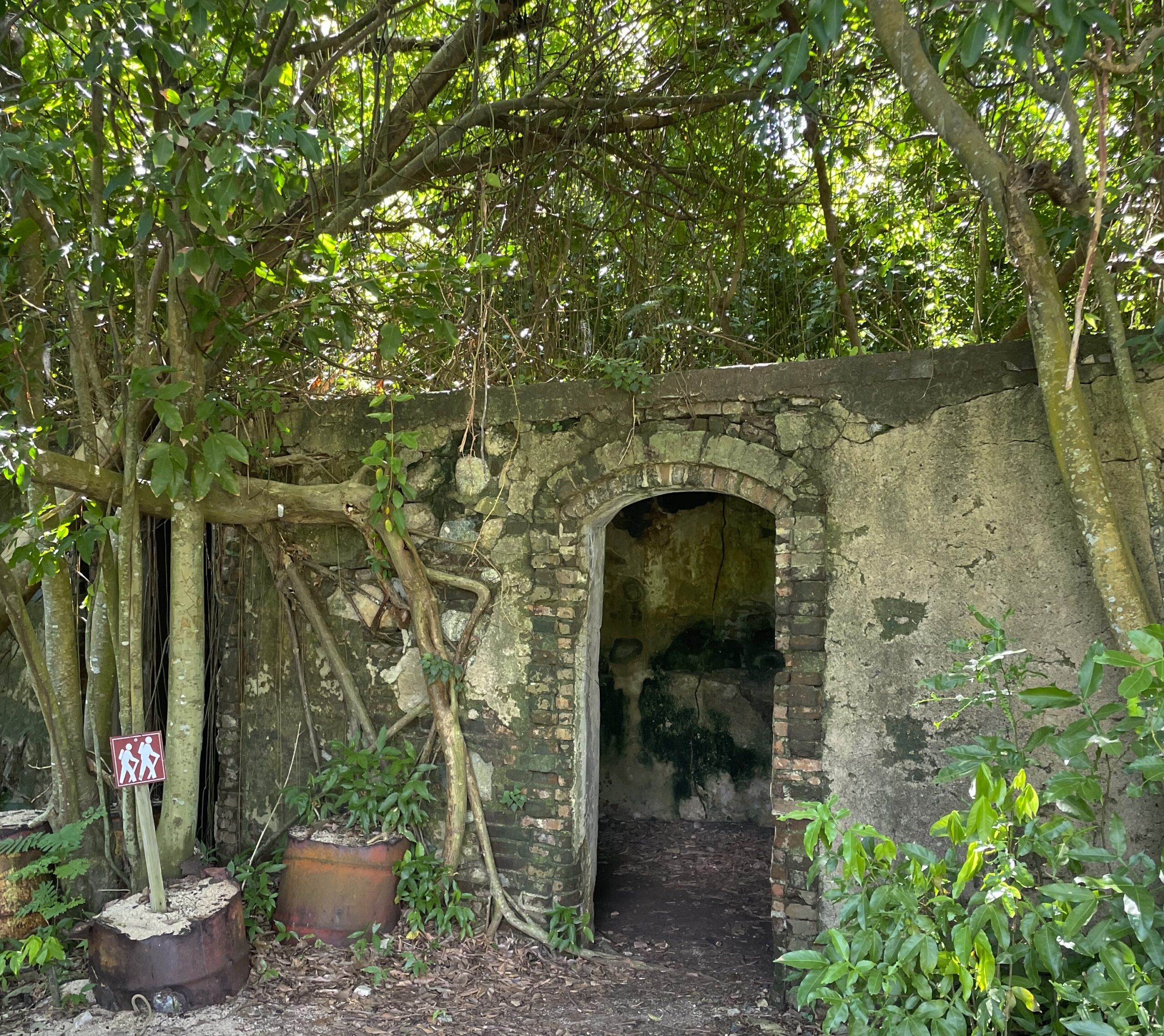
This hike explores some ruins being reclaimed by the forest. The interior of Vieques is rarely explored by visitors; this is a good option if you are looking for an adventure off the beaten path. There are a lot of spiderwebs, so grab a stick unless you want to use your face to clear the trail of webs. I did a short loop that took no longer than 20 minutes total, but I believe you can go further.